
Public input sought on Rifle Garfield County Airport Layout Plan
Open house from 4:30 to 6 p.m. on December 4
PRESS RELEASE
November 24, 2025
The Rifle Garfield County Airport is hosting an open house on December 4, to provide the community with an opportunity to view the facility’s developing Airport Layout Plan (ALP), which will guide the airport for the next 20 years. The event, which takes place from 4:30 – 6 p.m., brings together planning consultants from Lochner and the public to view the 20-year proposed planning.
The goal of the ALP is to maximize airport use for the community and pilots who fly here, work here, and rely on the facility for firefighting, medical flights, or recreation.
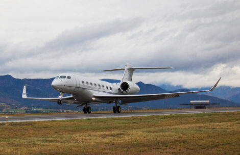
“The airport provides $80 million in annual economic impact to the community. We are one of the busiest general aviation airports in Colorado,” said Rifle Garfield County Airport Director Sam Carver. “We sell 2.5 million gallons of aviation gas and jet fuel a year and have nearly 19,000 landings.”
The airport’s clients include multiple companies that are currently building hangars. The airport’s infrastructure includes the established buildings of long-time fixed base operator Atlantic Aviation, complemented by the start of new development from Vantage Aviation.
Priorities include expanding helicopter landing areas to move helicopter flights away from the airplane aviation areas to reduce congestion during peak times. This will facilitate faster deployment of helicopters for critical services.
During peak times, the goal is also to get aircraft onto runways in a timely manner to avoid affecting takeoffs. For this, additional newly engineered crossovers between the taxiway and runway are proposed, so that small aircraft may take off while larger aircraft await clearance from Denver.
Another focus is strategically specifying where hangars can be built, so that future airport use will be available as needed. Also, existing county land may be used for more parking space on the south side of the airport.
The plan projects that nearby private landowners may choose to expand development with land leases for businesses in future years. New runways are not in the 20-year projection at the airport.
“No new runways are planned, and we do not have the land for another runway,” said Lochner Aviation Lead Judd Hill. “Also, the amount of traffic the current runway could provide would be as high as 230,000 takeoffs and landings a year to fully utilize it. That would be as much traffic as Rifle, Grand Junction, and Montrose all do now, and projections do not show increases to occur to that level.”
Lochner, a planning, environmental consulting, design, construction engineering, and inspection company based in Chicago, IL, is an infrastructure services provider for aviation, surface transportation, and water clients across the United States.
The basis of the plan is to maximize what the airport currently has for future needs. The ALP includes a new inventory of what is at the airport, what pilots use every day, technical use of the airport, and parking. The plan evaluates a demand forecast and looks for deficiencies in immediate needs. It also defines what should be protected for long-term future development.
Following the open house, the plan will be finalized and provided to the Federal Aviation Administration for review. The FAA oversees such plans, which are required for any future grant funding.
The airport is located at 0375 County Road 352, Building 2060, east of Rifle. For more information on the airport, visit the Rifle Garfield County Airport website.